Wednesday, April 27, 2016

Antelope Island

bison on Antelope Island, Utah
Bison on Antelope Island
Sit back while I hum a few bars...Oh give me a home, where the buffalo roam, where the deer and the antelope play...

OK, all done! This was one of the best places we went on our trip. It's a whopping big ten bucks to get on the island and we were there almost 5 hours. You can camp here and hike and go swimming or just hang out on the beach but all around you are these fantastic animals and views.

The bison go where the bison go and you stop the car or walk in a different direction if you come across them. Bison are like other ruminants in that they spend a heck of a lot of time grazing. It was pretty hard to get a photo of one with it's head up. And that's where your troubles start. When bison stop doing what bison do because there are humans around it's because they are warning you. If the bison looks directly at you and does not then resume grazing that's your first warning you're too close. Next comes the pawing and snorting and tail waving. Still standing there? Not a good idea. This is what happens. (No need to watch the whole video, the money shot is the still photo. See the legs? That's the offending guy mashed up against the fence.)

BTW, these are bison. 'Buffalo' comes from a lot of misnomers from lots of different languages. (Le boeuf from the French explorers to the English changing that to la buff to buffler to buffalo. But they're really bison. American bison.) But you can call them either name, they're not about to answer.
bison on Antelope Island, Utah
Bison not doing what bison do, we drove away!


pronghorn antelope on Antelope Island, Utah
Pronghorn antelope - native to the island

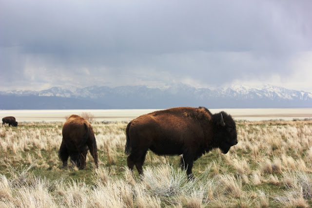
Bison on Antelope Island, Utah
More bison on the salt flats of the Great Salt Lake


Bridger Bay on Antelope Island looking off to the Wasatch Mountains

Chukar Antelope Island, Utah
Local bird called the Chukar. They popped up all over.

Chukar making its getaway.

Moi

Another antelope


Us on Antelope Island

Looking off to the Wasatch Mountains. Where we are is about 4600' above sea level.

That white van off in the distance is where we parked the car before we started hiking straight uphill.
What's interesting about this hike is that all along the side of the narrow trail were bison pies. (Like cow pies pretty much.) Which means, we figured, it was only a matter of time before we rounded a corner to find a small herd of bison grazing. I can truthfully say I was not looking forward to that.

As it was, we did see them down below. And, yes, that's a walking trail they're grazing around.

Bison herd by White Rock Bay

White Rock Bay, Antelope Island, Utah
White Rock Bay

We interrupted this coyote and its mate in the process of stalking a chukar that was standing in the middle of the road. Not sure if they would have chased it down as the chukar had a ample room to fly away. But it was interesting to see the coyotes meander off. This one knew we were there, we stopped the car right on the road where it had just been. When we didn't drive off they both loped off into the scrub.

Coyote studiously ignoring us.
Fielding Garr Ranch is about as far as you can drive on the island. The trail continues on but it is more of a horse, bike and walking trail at that point. The original house and other structures are open to walk through. This guy was coming out from under the bunkhouse. It was just starting to warm up enough. I asked one of the guides who said they'd be quite prevalent pretty soon. They are non venomous and are useful for keeping the rodent population under control. Something definitely useful on a farm or ranch.

Gopher snake. It was, as you can kind of see, crawling out from under the building.

One more bison for the road...

More bison
You know, it doesn't look that big with the telephoto lens. But it was easily the size (and weight) of the Chevy Cruze we were driving.

After this we head east again on our way to Arches National Park. Another amazing day.

White Cedar Inn Bed and Breakfast 178 Main Street Freeport, Maine 04032

Sunday, April 24, 2016

Bonneville Salt Flats

I'm going to guess the first thing you think of when you hear 'Bonneville Salt Flats' is not the salt on your dinner table. And yet...speeding by at 80 MPH on I-80 just beyond Salt Lake City this is what you see - Morton Salt. That white cone just left of center is not a building, it's your seasoning for that yummy steak you just pulled off the grill.

Morton Salt Works
More amazing piles of salt

We set out on this bright, cheery April day to do something we've both wanted to do since we were little kids - drive really fast on the Bonneville Salt Flats! There were no events scheduled so we figured we'd have the whole place mostly to ourselves as it was a Sunday in Utah. A lot of stuff is closed on Sunday. Luckily, not our National Parks, Monuments and BLM lands. We hit no traffic at all the entire trip out and back. The occasional car or truck, but the cruise was set for 80 and 80 we did.

As with other places we stopped at on this trip, I did a little research (little being the operative word) and I had a map (map being very important throughout the entire trip). I found there is a rest area along I-80 that was built pretty much especially to view the salt flats without having to exit the highway. Unfortunately, I misread the directions and thought it was about 15 miles west of where these photos were taken.

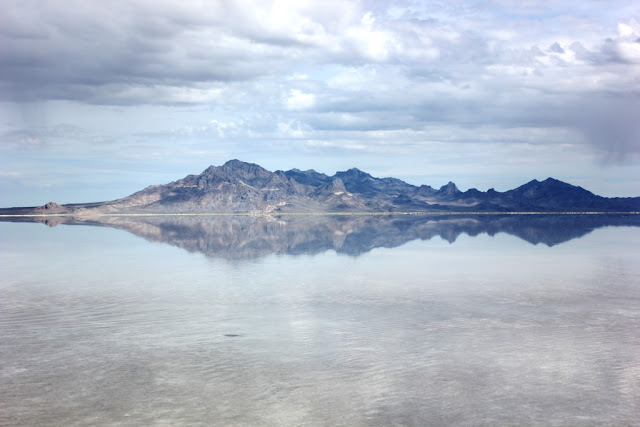
So, we pulled over here to get out and stretch. Even doing 80 MPH it's a 2 hour drive. We were getting close! We started seeing signs for Bonneville. I think these are some of the best pix I've ever gotten of reflections - the water was completely calm. There are a few ripples where people were taking their shoes off and wading in. And walking pretty far without getting in much past their ankles.

OK, time to move on. The excitement was building. Bonneville! The fastest Indian (motorcycle). The fastest car (630 MPH). The fastest bar stool (yes, there is a classification for that record).  People have been racing here since 1896 (bicycles). And we were next. Not sure how fast our little Chevy Cruze was going to go but we were ready to give it a run for our money.

Bonneville Salt Flats, Utah
Ink blot #1 - the water was so completely calm I got the bits of dark rain clouds reflected on the surface.

Silver Island Mountains, Utah
Ink blot #2 - Silver Island Mountains

Silver Island Mountains, Utah
Ink blot #3 - you can see the rain falling
Getting closer! It's weird, you get off the interstate and it's a truck stop with a lone sign pointing out to what seems like the middle of nowhere. But, there it was...Bonneville Salt Flats! I have to stop here to tell you a story - my parents have been out here before and they always have a story - here it is:

"We're driving down the road (below) and this guy is standing in the middle of it. We pull up to see what he wants and he says it's $5 to drive out because of an event. But we're going to get a hot dog and a soda once we get out to where the other cars are. And the guy points off into the distance. So, we gave him $5 and drove off."

You know where this is going, right? There's no hot dog and soda and the guy is long gone, having made several hundred dollars in a couple of hours. Who knows how many times he does that in a summer!

Bonneville Salt Flats sign
Bonneville Salt Flats sign.
So, we're driving down what seriously looks like a landing strip, you can see the shimmer on the horizon, and what appears in the shimmer? 2 guys. We look at each other and swear we are not paying $5 for a fictitious hot dog and soda. We drive on, resolved.

Although they are walking, it's really hard to tell if they're still in the road or not. We're doing about 45 MPH at this point. There is salt as far as we can see along the edges and we can see where cars have driven off and back on the paved surface again. It looks a little...soft. Trying to figure how you can get up to 630 MPH on what looks like a beach.
The 'runway' to the Salt Flats.
And then we get to the end of the road. And the pavement just stops and the salt flats begin. And so does the water. Yes, that wonderful view from the rest area on I-80 IS the Bonneville Salt Flats. And they are under water. Inches of water. Not-able-to-drive-thru water.

We look at each and laugh. We've built this up over the course of planning the vacation.Over the course of the two hour drive. Bonneville. We're going to drive on the legendary salt flats. We're going to break our own personal land speed records. Not.

At the salt flats. At the very damp salt flats.

Where the road ends. That is a huge hunk of salt Rock is standing on.

OK, so all is not lost, right? There is a racing museum out here in West Wendover, Nevada. We'll go to that. We can look at whatever they have. Maybe some cars. Motorcycles. One of those bar stools. Back in the car we have some lunch and look over the map. We plug the museum info into the GPS. Michelle tells us, 'Please drive to highlighted route,' and we're off again.

Back in Nevada the first thing you see is a casino. You can't not know you've crossed the state line! Michelle takes us along the main drag and lets us know we've arrived at our destination. Now Michelle is sometimes temperamental. She tried to convince us to turn left off a switchback mountain on our last vacation. Or maybe that was Samantha. Usually, we get pretty close to our destination. We were now in front of the police station. 

Wouldn't that be interesting! A museum dedicated to zipping along at outrageous speeds and it's in a police station! No. No it isn't. We drive back up the street and she insists on putting us back in the same location. I call the phone number on the website. I get a taxi driver. He's a little surprised that a museum that hasn't been built yet is using his phone number. But at least he solves our problem.

We laugh again. Poor Rock is batting 0 for 2 for his big day out. We decide to stop at McD's for a shake and decide where to go next. I'll let you think about Rock's batting average for a moment. Yup, the only McD's in the Western world that does not make shakes. I'm not sure we can laugh at this point.

It's ok. There's a ghost town out here, we'll go look at that. That's a story for another day, though. Next up, we're off to Antelope Island.

White Cedar Inn Bed and Breakfast 178 Main Street Freeport, Maine 04032
Thursday, April 21, 2016

Ghost Towns of Utah

The ubiquitous lizard
Last time we went out west I bought a huge map of the Southwest United States. The map covers Arizona and large parts of Colorado, New Mexico, Utah, Nevada and California. (HEMA maps if you're a map person.) What's fun is odd little roadside 'attractions' are on the map. Looking at our drive thru Utah I kept finding 'ghost towns' listed here and there. Now I'm sure you have a picture in your head of what a ghost town looks like. We sure did. Most of what we found were 2-3 abandoned buildings either in the middle of nowhere or in the middle of a very nice, sprawling housing development!

If you want to make a vacation side trip out of visiting ghost towns in Utah let me suggest this website: Ghost Towns of Utah. It is not the easiest map to use but it does have good info.

Here are some of the 'towns' we did find. A few were wiped out in a landslide not that long ago.

Silver Reef has been taken over as an historic site so the area is somewhat preserved. There is a museum in the old Wells Fargo and a nicely laid out town diorama in another building. (Complete with teeny outhouses behind each building!)


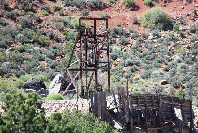
Old mine rigging Silver Reef Utah
Old mine rigging Silver Reef, Utah

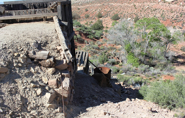
Old mine shaft Silver Reef, Utah

Old and new. Silver Reef, Utah

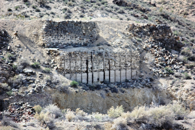
Remains of street with stone walls of houses. Silver Reef, Utah
 Silver Reef is off Rt 15 just north of St George, Utah. There are signs but not where you expect them. There is a small shopping center that looks exactly like what you think a ghost town should look like. (Think Bonanza.) Drive past the shopping center and go down the road behind it. Look for the 'Wells Fargo' sign.

The next one we tried to see was when we were at Bonneville (a whole other blog post). We found the road (Ghost Town Road) and drove to the end. There was a chain link fence with a sign saying the ghost town wasn't open. Hmmm. I wouldn't think a ghost town would be 'open'. We drove on. 

We did find this ghost town, though. After a meander through the open range lands of the high plains. This is Gold Hill.

Wandering in the high plains. Correct, there is nothing here but the occasional cow or steer.
The correct road to Gold Hill. Not a whole lot different from the incorrect road. (The hills are a dead giveaway, tho, aren't they?)

Old building in Gold Hill, Utah

Part of the old mine works in Gold Hill, Utah

Goodwin Mercantile Company Gold Hill, Utah

More of the old mine workings
 Because there are no real directions to Gold Hill, we did do a bit of meandering in the open range. There were small herds of cattle and one nice sized flock of sheep that wandered across the road as we drove along. But, with just the animals to keep us company, we turned back and tried another road. The one with the arrow pointing to 'Gold Hill' was definitely the right road. Some of the area we drove through is a reservation. We found we did that a lot in Utah.

Open range (no fences on side of road, cattle have free movement). The speed limit on this tiny, 2-lane road is 70 MPH.

 The next batch of ghost towns we looked for was on Rt 6 from Sandy, Utah to Green River, Utah. Again, wanting to have an idea of where to stop I searched for 'ghost towns on Rt 6 Utah'. What did I find? A Wiki entry claiming Rt 6 is the most deadly road in the US. Over 50 fatalities/year occur on this road. Why? Maybe because the speed limit is 65, the road is a series of blind curves, the oncoming traffic might be a triple semi. Yikes! And let's not forget the wildlife jumping out in front of you. (Saw a lot of dead deer on the side of the road. At least the vultures were happy.)

I couldn't take too many pix along this road as I was mostly dizzy and hanging on the whole way. I did get this one, tho - a coal seam in Carbon County. Kind of neat. You can see the black lines of coal on the left. There is a coal mine right there behind the road cut.

Coal seam in Carbon County


This was the only set of old buildings we found. Others were wiped out in landslides.

Soldier Summit, Utah

Soldier Summit, Utah

That's it for the Ghost Towns we found in Utah. Next time we'll be having a look at the Bonneville Salt Flats. Start your engines! 

White Cedar Inn Bed and Breakfast 178 Main Street Freeport, Maine 04032

Wednesday, April 20, 2016

Tuscan Scrambled Eggs

Tuscan Scrambled Eggs
You're going to think the Tuscan eggs are a lot like the Irish eggs, and they are. But, we've spiced things up a bit by adding Gorgonzola cheese to the mix. This came about over drinks (SO many good recipes do) and dinner. I had ordered a pasta dish with Gorgonzola cheese and even tho I don't particularly care for eggs in any form, I thought the creamy cheese would go really well in this dish. The way it just melts and flows when warm was perfect for the mix of heavy cream and scrambled eggs.

To make this for your sweetie of a Sunday morning, have these ingredients on hand:

6 eggs
2+ tbsps of heavy cream

1 tbsp Gorgonzola cheese
butter for the pan

12 cherry tomatoes (grape tomatoes also work), sliced in half
2 scallions, chopped (save greens for topping)
pinch of thyme
2 tbsps olive oil (or, use thyme-flavored oil)


Add butter to fry pan, enough to cook eggs. Heat, but do not brown butter. While heating, whisk eggs. When fry pan is ready, pour eggs in and let set up slightly. Then, gently fold eggs over and over, scraping bottom of fry pan to cook through. (Like you would usually cook scrambled eggs.) When eggs are just about done, pour in 2 or more tablespoons of heavy cream and sprinkle in the Gorgonzola cheese, turn off heat and fold the cream & cheese gently into the eggs. The eggs will immediately get creamy. (Don't add the cream at the beginning, it doesn't come out the same way.)

At the same time, in a second fry pan under super low heat, warm the olive oil. Add the tomatoes, scallions (reserving the green tops) and thyme. What you are doing here is merely warming, not cooking the tomatoes and scallions.

When the eggs are done, plate and immediately top with tomatoes and scallions. Add the green, chopped tops of the scallions to the top of the eggs. Serve with your favorite breakfast meat and toast or biscuits. Put on a tray with a flower, mimosa and silverware.


Serve. In bed. ;-)

White Cedar Inn Bed and Breakfast 178 Main Street Freeport, Maine 04032

Monday, April 18, 2016

Valley of Fire

Chasing the setting sun
We headed west on March 30 for our grand tour of the 'Mighty Five' National Parks in Utah: Arches, Canyonlands, Bryce Canyon, Zion and Capital Reef. Before your expectations get too high, we did not see all of them. Keep reading to understand why it was impossible!

Of course, we flew into Vegas to see number one son and his wife. (Seriously, the only reason I would ever go to Vegas. I just don't 'get it'.)

Leaving Las Vegas we pointed the car east backtracking over ground we flew across just the other day. Our first stop was the Valley of Fire, a Nevada State Park. If you are in Vegas and want to get out for the day, this is a wonderful place to go! It's less than an hour's drive and you're in a whole other world. I would not suggest going to a place called 'Valley of Fire' at high noon in July. It was quite toasty in April!

Pick up a trail map and plan your hikes. Bring plenty of water, sunscreen and proper clothing.

A couple of place names piqued our interest so we drove on in search of the Beehives and Mouse's Tank. (Before you hit the trails be sure to walk thru the Visitor's Center, there's a lot of history out there you're going to miss if you don't stop.)

Photos from the day at Valley of Fire: 

Beehives - Valley of Fire Nevada

Wind and rain - Valley Of Fire Nevada

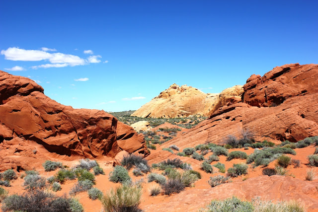
Desert vista - Valley of Fire Nevada

Fish petroglyph - Valley of Fire Nevada
 Once you start noticing the petroglyphs they are everywhere. They are formed, depending on who made them, by pecking (using a tool to chip away at the rock varnish and into the stone beneath) or grinding (scratching away at the surface) or a combination of both. (Rock varnish: a layer of manganese and iron oxides that adheres to the surface of rocks.) This one looks like a huge fish. It's about 3 feet across.

Geology - Valley of Fire Nevada
 I love the rock formations here. I bought one of the Roadside Geology books in Utah. Have to take a closer look at it.

Lizard - Valley of Fire Nevada
 Lizards were another thing that once you noticed them they were everywhere. A lot of times they blended right in with their surroundings and we only saw them if they moved or some kid with 20/20 vision yelled, 'Hey, there's another lizard!'

Moi on vacation


Petroglyph - Valley of Fire Nevada
 So, we're thinking this petroglyph just got off its horse after a long ride.

Petroglyphs - Valley of Fire Nevada
 Make sure you hold hands with your toast while crossing the desert!

Surveying the 'other' rocks.

Path to Mouse's Tank - Valley if Fire Nevada
 This is the sand that turned my boots a bright red.

Tiny arch - Valley of Fire Nevada

Rainbow Vista trail - Valley of Fire Nevada

Small arch - Valley of Fire Nevada

Vacation feet


Angel wings - Valley of Fire Nevada
To be continued...on the road to the Silver Reef Ghost Town.

White Cedar Inn Bed and Breakfast 178 Main Street Freeport, Maine 04032