Friday, June 17, 2016

Glidden Middens and Whaleback Shell Middens


Great Salt Bay, Newcastle boardwalk
Boardwalk thru the tidal marsh at Great Salt Bay
Give us a few hours with nothing on the horizon and we'll hop in the car and go for a drive! This is a place I have wanted to find since moving here. Yes, we went looking for a 1000+ years old shell dump. (An odd thing to go search for, I know, but it's a state historic site so other people have been here before us.)

Salt Bay Preserve Heritage Trail
Along the Salt Bay Preserve Heritage Trail


Doing a search for the shell middens I found the Damariscotta River Association (they offer tons of trails and educational programs). The website has trail maps, hours of operation, driving directions, and more. Print out a map before you go. (There are detailed, hand-drawn maps at the trailhead, but you can never be sure there will be one the day you go.)

Great Salt Bay
Great Salt Bay from the trail


There are two completely different trail systems you can take for two different experiences with the shell middens. On this trek we took the Salt Bay Heritage Trail in Newcastle. Next time we'll try the trail on the opposite side of the river in Damariscotta - Whaleback Shell Midden State Historic Site


It was a gorgeous June day that ended up in the 80's by late afternoon.

Here are some photos from the trail:

Glacier Rock

Bridge across the tidal river (you can see this from Rt 1, I always thought it was someone's dock)

Crushed shells on the trail
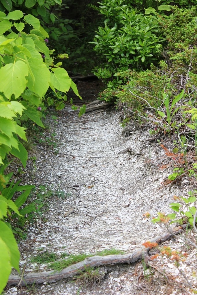
Thru the woods

Trail marker


 The trail on this side of the river is very well maintained. (And very well marked as you can see above.) It was an easy walk, albeit quite a bit longer than I thought it would be. Ah, I just went back to the map on the DRA website - this is a 3 mile hike! Explains so much. I'd hazard a guess it's 2 miles on the way out and 1 mile thru the woods on the way back, if you do a round trip hike. (More on that later.) There are a lot (a LOT) of tree roots so wear good boots or shoes. Not a place for flip flops. (More on that later, too!)
It was a lovely day and the breeze off the bay was perfect. We saw these cormorants just before we headed back toward Rt 1 (which you can hear on and off throughout the hike).


Cormorants
 As we neared Rt 1 again we checked the map. We were getting close to the sheep tunnel. When Rt 1 bisected the farm back in the 1960's this tunnel was added under the road so the sheep could move from field to field without wandering onto what is now an extremely busy section of road! 

Sheep tunnel under Rt 1

Ok, let's talk about the tunnel. Firstly, do not read It by Stephen King before this hike. That tunnel is the reason why. Secondly, wear good shoes - waterproof boots that come up to your ankles. This is not the place for bare feet or flip flops. Think oozy slime. Good thing - we saw no spiders!

We also did not walk thru there. Even Rock said, "Um, no." So, up and over we went. Rt 1 at this point is a fair straight away so traffic is moving. It's quite obvious we were not the only people to do this as we easily found the trail on the other side down from the road. However, I cannot recommend doing it this way. It does not appear that this water is from the tide, rather it appears to be from runoff from the road. The tunnel is slightly longer than a two lane road with breakdown lanes is wide. I'll leave it to you to measure it.

From here it's a short hike to the middens. Watch for the sign; it comes up quickly. If you miss it, you'll walk all the way back to Rt 215 and not see what you came for! 

I will say here I was expecting something completely different. Now that's because I forgot it's been a thousand years, tons of people walking along here, years of digging up the shells for fertilizer in the 1880's, lots of high tides and general wear and tear. However. If you have the sort of imagination that impels you to go looking for a shell midden laid down THAT long ago, you'll find it kind of awe inspiring. Stop. Take a moment to think about this. Look at the shells under the tree roots, shells in the water, shells as far as you can see and think about the families of Abenaki and other Native tribes foraging along the Damariscotta River a thousand years ago! Summer camp. Maine's shores were vacationland long before we came along. And even though you can see Rt 1 just up the way, it's so peaceful here. Really quiet. Inspiring.

If you are not up for a 3 mile hike, then check out the very short trail just across the Damariscotta River at Whaleback Shore. (Please remember this is a state historic site and do not remove any shells, plants, vegetation, etc. If you absolutely have to have oyster shells, go to King Eider's Pub in Damariscotta and order up a dozen!)

Rock getting a close up look at the shells under the forest floor

Just a tiny piece of the area history

View across the Damariscotta River to the Whaleback Shell Middens Trail and Calf Island


 And there you have it! The Glidden Middens on the north side of the Damariscotta River. The Whaleback Middens are on the south side and we'll save that up for another day.

Some caveats: I used bug spray on my hat for the black flies and on my pants and boots for the ticks. But the mosquitoes were so bad on the last mile of the hike that my neck looks like Dracula had a field day. We both had to roll our sleeves down and I pulled my hands up into my sleeves and stopped taking photos the mozzies were that bad. 

At one point on the way back I swear deer were the only living beings that walked the trail before us. The grass was knee high and the ground was very boggy in some places. Did I mention the mosquitoes? The orange markers kind of disappeared in the boggy areas so we were hoping we were still on the trail. We followed some fresh deer tracks for awhile.

My suggestion? Turn around and go back the way you came. OR, use a lot of bug spray, be sure you have boots, and check for ticks when you get home. I took a shower and dumped my clothes in the wash.

However, there was a beautiful pond with hundreds of lily pads on the walk back. It was very serene. If only the mosquitoes weren't there.

If you love hiking in the woods, this is the walk for you. If you'd rather not then opt for the trail on the other side of the river where it is a much shorter walk if you park in the Whaleback Shell Middens parking area.

Great Salt Bay Trail sign (park across the street)

Detail of the shells on the shore
 Pair this hike with the Damariscotta Mills fish ladder and alewives run in May and June.


Monday, June 06, 2016

Pipe Springs National Monument

Pipe Springs National Monument
We were headed to Zion National Park but we didn't plan our location very well. We stayed in Kanab, Utah which looked like it was close enough but it's about an hour away from both Zion and Bryce Canyon. With the overcast skies and realizing we would have to take a bus to get around in Zion, we decided to look closer to town for things to do.

Pipe Springs National Monument is in Arizona, just across the border from Utah. If you're there in late spring or summer you can also go to the northern rim of the Grand Canyon. It was closed when we were there (early April) because there's still a chance of heavy snow in the area.

The Pipe Springs fort was originally set up as ranch by the Mormons. Because they built the fort almost directly over the spring, they controlled the water supply in the area, eventually causing the Kaibab-Paiute to move on and decreasing the usability of the soils by overgrazing cattle and sheep.

In the photo above you can see the main 'castle' to the right and the bunkhouse to the far left. We hiked around the bunkhouse, up the cliff-hanging trail to the top. Yes, more cliff-hanging. We had an excellent tour of the fort by a local Kaibab-Paiute. (Go early in the morning, there's no one else around!) 

Deseret Telegraph
With the completion of the line from the fort up through Salt Lake City and into Idaho, Arizona had its first telegraph system. Run mostly by the plural wives of the Mormons, the line was sometimes used to alert the folks at Winsor Castle of incoming federal marshals looking for polygamous families. Part of the creation of the state of Utah was dependent on the renunciation of polygamy. But, what do you do with all those extra wives and children? You hide them in the desert.

The original State of Deseret extended from the present central Arizona west to the Pacific Coast in southern California, north to parts of Oregon, Idaho and Wyoming and east to Colorado and New Mexico, covering the entire state of Utah.

After the excellent tour we walked around the grounds and hiked up the hill behind the fort. To show what the fort would have looked like when in use you'll find a variety of livestock in pens just outside the walls.

Cactus trains
Cactus trains.
 I thought these cacti were interesting, the way they grow in rows that meander this way and that.

Cacti

View from the trail behind the bunkhouse.

Kaibab-Paiute Reservation and Tribal Offices

The Old Trail runs through the desert sometimes parallel to and sometimes bisecting US roadways.
Mallard

Mallards

Mule

Rooster

Steer

After Pipe Springs it was time to turn the car toward Nevada and think about getting on the plane back to Maine. But, we still have one more day on the road and a stop at the Lost City Museum in Overton, NV.

178 Main Street Freeport, Maine 04032

Friday, June 03, 2016

Canyonlands National Park

Canyonlands National Park
Day two of our stay in Moab, Utah was spent in Canyonlands National Park. The park is divided up into two major sections - Island in the Sky and The Needles. I didn't realize this when planning our vacation so we didn't have time to see both areas. (We're talking hundreds of square miles here!)

Just like at Arches National Park, Canyonlands has an information center where you can pick up a map of the area. (There is a tourist info center in Moab where you can get much more detailed maps if you're headed into the back country.)

The kid at the admission booth asked if we had a senior pass; I put my hat back on. We were 6 months too early to get the $10 lifetime senior pass but maybe we'll pick one up in Acadia this fall.

Again, bring plenty of water, sunscreen, sunglasses and a hat!

We made good use of the trail map, marking off the different sights we wanted to see. The hikes are broken up into Easy, Moderate, and Who Are You Kidding. (Just joking, that last section is really called 'Strenuous'.)

Mesa Arch was our first stop. This is a relatively easy (compared with the slickrock climb yesterday at Arches) half mile trek. There are cairns showing the way.

Canyonlands cairn

Moi at Mesa Arch


View thru Mesa Arch.
 Yup, there is nothing on the other side but a sheer drop.

Stairs along Mesa Arch trail.

This is a brutal climate.

After Mesa Arch we drove out to Upheaval Dome. Again today we started early. A little later than yesterday but we were at the park by 8 AM. Although you can take this road from Moab, it's not recommended unless you have a high clearance 4x4.

Shafer Trail
Yes, that's the road. Not a guard rail in sight. Two lanes. No thanks. 

Upheaval Dome Canyonlands National Park Utah
Trail to the second overlook on Upheaval Dome.

Upheaval Dome Canyonlands National Park Utah
At the first overlook on Upheaval Dome.
The hike to Upheaval Dome is fairly easy to the first overlook. So easy, in fact, a woman from France was hiking in ballet flats and wearing a skirt. She did not continue on the the second overlook. (The whole trail is listed as moderate but mostly because it's fairly uphill the whole way with lots of loose gravel and rocks to get around.) Plan a few hours if you want to hike to the end of the trail.

Although the second trail looks fairly flat and open there were too many 'cliff hangers' for me. I encouraged Rock to go on and I would just sit and watch the lizards and birds, he said he'd stay with me. (He's always got my back.)

The tourist info guide is really good for people like me who have problems with vertigo. The trail listing for Whale Rock sounds reasonable until this line: Be careful, steep drop offs. Um, no can do. We moved on to the Grand View Point Overlook where you can see the Green River coursing through the canyons. The Colorado River is just out of sight.

Grand View Point Overlook

Dirt bikes on the 100 Mile Trail. (First bike is pretty much in the center of the photo, second one is at the lower left.

Grand View Point Overlook
Us, Grand View Point Overlook
OK, so this wasn't too bad. We're up a few hundred feet but there's a fence so I'm not too worried. After this easy bit we walked the mile long trail that runs alongside the edge of the cliffs. We kept running into the same people we had seen the day before at Arches. They were moving on to The Needles the next day, we were headed to Kanab. 

I'll leave you with a few more scenery shots and more 'Rock hanging off edge of the world' photos. 

Kind of like the lone cypress on the PCH in California.

As close as I will get to the edge.

Rock gets much closer to the edge.

Beyond the edge.

Contemplating the edge.

Just amazing.
More shots from the ride back to Moab...

Open range.

Windblown on the Colorado.
Great bike trail along the Colorado.

Next up we head to Kanab, Utah. Our intention was to see Bryce Canyon and Zion National Parks but it was on and off rainy for the next 3 days so we went to Pipe Springs National Monument and the Lost City Museum.

178 Main Street Freeport, Maine 04032