 |
| The ubiquitous lizard |
Last time we went out west I bought a huge map of the Southwest United States. The map covers Arizona and large parts of Colorado, New Mexico, Utah, Nevada and California. (HEMA maps if you're a map person.) What's fun is odd little roadside 'attractions' are on the map. Looking at our drive thru Utah I kept finding 'ghost towns' listed here and there. Now I'm sure you have a picture in your head of what a ghost town looks like. We sure did. Most of what we found were 2-3 abandoned buildings either in the middle of nowhere or in the middle of a very nice, sprawling housing development!
If you want to make a vacation side trip out of visiting ghost towns in Utah let me suggest this website: Ghost Towns of Utah. It is not the easiest map to use but it does have good info.
Here are some of the 'towns' we did find. A few were wiped out in a landslide not that long ago.
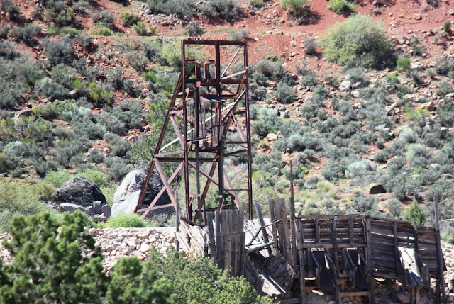
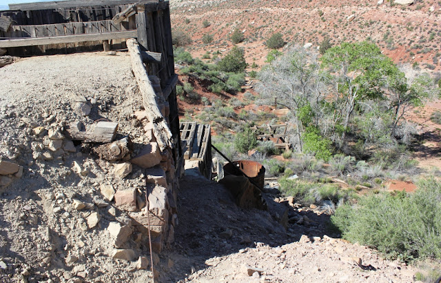
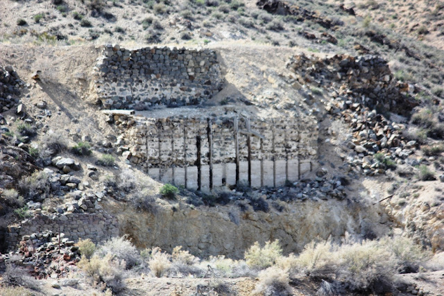
Silver Reef has been taken over as an historic site so the area is somewhat preserved. There is a museum in the old Wells Fargo and a nicely laid out town diorama in another building. (Complete with teeny outhouses behind each building!)
 |
| Old mine rigging Silver Reef, Utah |
 |
| Old mine shaft Silver Reef, Utah |
 |
| Old and new. Silver Reef, Utah |
 |
| Remains of street with stone walls of houses. Silver Reef, Utah |
Silver Reef is off Rt 15 just north of St George, Utah. There are signs but not where you expect them. There is a small shopping center that looks exactly like what you think a ghost town should look like. (Think Bonanza.) Drive past the shopping center and go down the road behind it. Look for the 'Wells Fargo' sign.
The next one we tried to see was when we were at Bonneville (a whole other blog post). We found the road (Ghost Town Road) and drove to the end. There was a chain link fence with a sign saying the ghost town wasn't open. Hmmm. I wouldn't think a ghost town would be 'open'. We drove on.
We did find this ghost town, though. After a meander through the open range lands of the high plains. This is Gold Hill.
 |
| Wandering in the high plains. Correct, there is nothing here but the occasional cow or steer. |
 |
| The correct road to Gold Hill. Not a whole lot different from the incorrect road. (The hills are a dead giveaway, tho, aren't they?) |
 |
| Old building in Gold Hill, Utah |
 |
| Part of the old mine works in Gold Hill, Utah |
 |
| Goodwin Mercantile Company Gold Hill, Utah |
 |
| More of the old mine workings |
Because there are no real directions to Gold Hill, we did do a bit of meandering in the open range. There were small herds of cattle and one nice sized flock of sheep that wandered across the road as we drove along. But, with just the animals to keep us company, we turned back and tried another road. The one with the arrow pointing to 'Gold Hill' was definitely the right road. Some of the area we drove through is a reservation. We found we did that a lot in Utah.
 |
| Open range (no fences on side of road, cattle have free movement). The speed limit on this tiny, 2-lane road is 70 MPH. |
The next batch of ghost towns we looked for was on Rt 6 from Sandy, Utah to Green River, Utah. Again, wanting to have an idea of where to stop I searched for 'ghost towns on Rt 6 Utah'. What did I find? A Wiki entry claiming Rt 6 is the most deadly road in the US. Over 50 fatalities/year occur on this road. Why? Maybe because the speed limit is 65, the road is a series of blind curves, the oncoming traffic might be a triple semi. Yikes! And let's not forget the wildlife jumping out in front of you. (Saw a lot of dead deer on the side of the road. At least the vultures were happy.)
I couldn't take too many pix along this road as I was mostly dizzy and hanging on the whole way. I did get this one, tho - a coal seam in Carbon County. Kind of neat. You can see the black lines of coal on the left. There is a coal mine right there behind the road cut.
 |
| Coal seam in Carbon County |
This was the only set of old buildings we found. Others were wiped out in landslides.
 |
| Soldier Summit, Utah |
 |
| Soldier Summit, Utah |
That's it for the Ghost Towns we found in Utah. Next time we'll be having a look at the Bonneville Salt Flats. Start your engines!
White Cedar Inn Bed and Breakfast 178 Main Street Freeport, Maine 04032


No comments:
Post a Comment